 Catalogue PIGMA
Format
Esri shapes
Type of resources
Topics
Provided by
Years
Formats
Representation types
Resolution
From
1
-
1
/
1
-
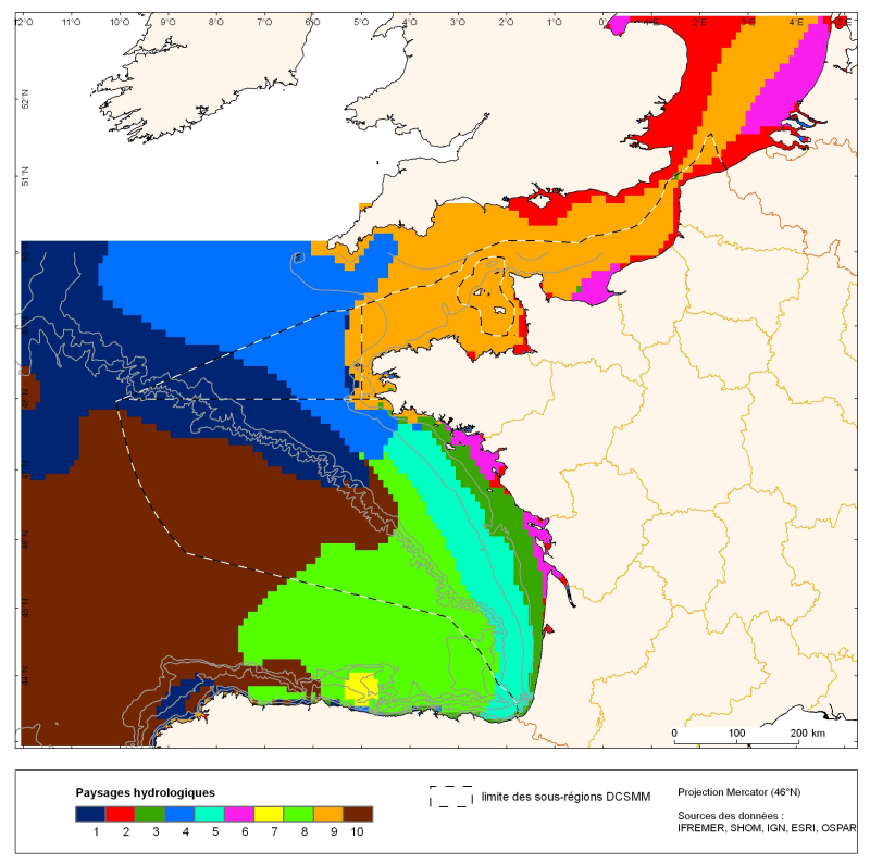
The distribution of hydrological landscapes is determined by a method of comparing multi-tables, to identify groups of individuals with similar variability of hydrological conditions during the year. The data used provides monthly tables showing the selected parameters, calculated over the entire geographic area with a resolution of 0.1 °. The variable chlorophyll-a is extra: it does not contribute to the discrimination of groups. This method identifies 10 hydrological landscapes with a similar annual variability of hydrological conditions.